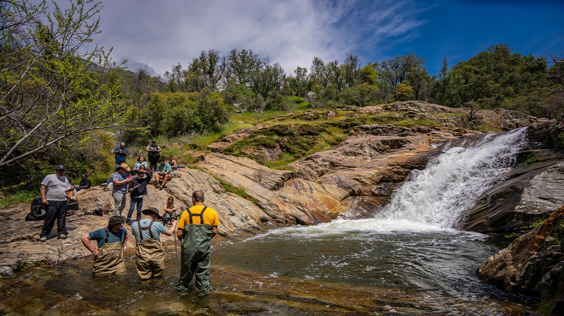
About 2,600 miles of rivers and streams run through Sequoia and Kings Canyon National Parks in Northern California. These waterways provide irrigation to the fertile San Joaquin Valley, whose agricultural production, including food manufacturing and wineries, generated more than $4 billion in 2023.
These waterways also serve as the perfect outdoor classroom to train the next generation of water resource managers, environmental scientists, and others who will help California better manage one of its most precious natural resources.
Every two years, John Keyantash, professor and chair of the Department of Earth Science and Geography at CSUDH, leads field work here and elsewhere in the Sierra Nevada mountains for students in his GEO 412 Rivers and Streams course.
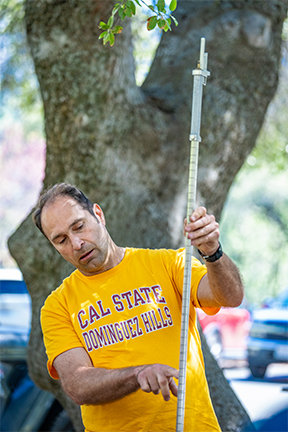
“This trip gives students a practical understanding of how and why we measure stream flow,” says Keyantash. “It’s a laborious process that requires measuring the depth, width, and speed of water, and also involves a lot of geometry.”
Students also learn about different flow characteristics and the transitions that cause variation, as well as changes in vegetation along river and stream banks that can be indicators of the overall health of a waterway.
“These are things that students in the class study closely as part of their education, but few of them get the opportunity to examine these environments up close and in person,” says Keyantash. “This class trip provides that opportunity. These are critical benefits for deepening their understanding of key academic concepts, but also in terms of enhancing their college experience.”
Why, in an age of rapid technological advancement, would vital water data need to be collected by hand? Keyantash says the U.S. Geological Survey and other agencies do incorporate automated systems in parts of California, but the technology is expensive and does not fully extend to smaller rivers and tributaries like the Kaweah River, where he led an April 2024 field trip.
“Manual measurements are still used quite often despite the use of automated measurement systems, which fall out of calibration because waterways reshape themselves over time,” says Keyantash.
The precise accounting of available water in the state’s rivers and streams has become critical for officials trying to address the challenges of climate change and increasingly severe drought conditions.
A recent study by scientists at the University of California, Berkeley published in the journal Nature Sustainability found that only about 8 percent of California’s waterways have automated monitoring systems in place.
“If we don’t know how much water is flowing through our rivers and streams, it makes it very difficult to make decisions on how to allocate it,” says Ted Grantham, co-author of the study, in an article in the Los Angeles Times. “We need to know how much water is available, and we need to know how much water is being used. And California is deficient in both of those areas.”
What’s at stake in the absence of reliable data is not just the future of California’s agricultural sector and its billions in annual revenue. Failure to monitor snowpack and expected water flow can leave vulnerable river ecosystems and the flora and fauna that rely on them at risk of destruction.
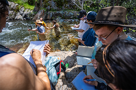
Keyantash’s students make their calculations using a technique known as the midsection method. In groups of two to three, they enter the waterway at a depth between the knee and waist. They first measure the width of the waterway, and then use a wading rod fitted with a small propeller to measure the velocity for several vertical subsections across the waterway and determine the flow in each column. The overall flow is the combined flow from each subsection. Students standing on the shore help with recording the data.
“Making these measurements and then doing the math is really the most practical way of determining the discharge of a particular stream,” says Keyantash.
Justin Beverly, a junior geography major, says Keyantash brings a sense of adventure to the class material that really shines through during the fieldwork exercises. “He always tells us that no two rivers are the same, and that there’s always something new to discover,” he says. “It felt good to be in the water. At first, the tools seemed a little primitive, but they’re quite good at giving us the data we need.”
Dylan Tramel, a junior majoring in earth science, has wanted to be a paleontologist since childhood. He hopes to work in North Africa to unearth new evidence of his favorite therapod—the dinosaur known as Spinosaurus aegyptiacus.
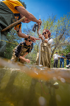
“I never really thought that a class on water would be that appealing to me,” says Tramel, who took the Rivers and Streams course because it’s a requirement for his major. “It’s really brought home to me just how precious a resource water is for us and how we need to be much more conscious about how we use it.”
The U.S. Geological Survey and the California Department of Water Resources manage about 1,000 automated gauges across the state. More are likely to be activated to close the gap in coverage noted by the UC Berkeley study.
But the manual calculation methods taught in Keyantash’s Rivers and Streams course will always have a role to play for CSUDH students who one day might work in local and state agencies that protect vital waterways and the communities that rely on them.
The field work also brings to life key topics covered in the Rivers and Streams course that can seem too theoretical. His students analyze data gathered by government agencies in the classroom, Keyantash says.
“But by getting out into areas like Sequoia National Park, Yosemite, or other areas where we do field work, we show them how to make those calculations for themselves by interacting directly with the state’s water systems.”
Beverly credits the fieldwork with giving him a new perspective on the complex issues presented in class.
“Lectures can feel a little abstract,” he says. “Nature isn’t abstract, and I’m constantly struck by the wonder and importance of it. Out in the water, you feel much more connected with the world.”

